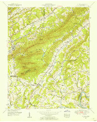
1952 Map of Luttrell
USGS Topo · Published 1954About this map
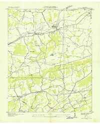
Clinch Mountain and Copper Ridge dominate this East Tennessee landscape, creating a series of parallel valleys defined by the Southern railroad and the winding Holston River. The railroad corridor serves as the primary axis for development, connecting settlements like Luttrell, Chesney, and Blaine. Agriculture and local commerce are centered in the fertile Richland Valley and Poor Valley, where small community hubs such as Richland and Red House are situated.
Find a feature on this map
78 named features on this map. Tap any name to fly to it.
Don’t see what you’re looking for? This feature index may not catch every label — zoom into the map to look around manually.
Map Details
Editions of this 1952 Luttrell Map
4 editions found
Other maps of this area

1897 · Maynardville
USGS Topo · 1:125,000

1900 · Maynardville
USGS Topo · 1:125,000

1935 · Luttrell
USGS Topo · 1:24,000

1935 · Mascot
USGS Topo · 1:24,000

1935 · Straw Plains
USGS Topo · 1:48,000

1935 · Graveston
USGS Topo · 1:24,000

1935 · Joppa
USGS Topo · 1:24,000
1935 · New Market
USGS Topo · 1:24,000

1936 · Gorryton
USGS Topo · 1:48,000

1936 · Powder Springs
USGS Topo · 1:24,000