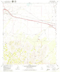
1979 Map of Luzena
USGS Topo · Published 1979About this map
Luzena serves as a central point in this high-desert landscape, where the Southern Pacific Railroad parallels the modern interstate corridor. The map reveals a transition from the drainage basins of Monk Draw and Gold Gulch in the north to the uplifted terrain of Maverick Mountain and Rough Mountain in the south. These southern peaks are carved by numerous canyons, including Angle Canyon and Buckeye Canyon, which provided essential water sources like Riley Spring and White Rock Spring.
Find a feature on this map
43 named features on this map. Tap any name to fly to it.
Don’t see what you’re looking for? This feature index may not catch every label — zoom into the map to look around manually.
Map Details
Editions of this 1979 Luzena Map
2 editions found
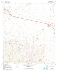
Other maps of this area

1917 · San Simon
USGS Topo · 1:125,000

1922 · Willcox
USGS Topo · 1:125,000

1926 · Cochise Head
USGS Topo · 1:62,500

1928 · Bowie
USGS Topo · 1:62,500

1943 · Dos Cabezas
USGS Topo · 1:62,500

1944 · Fisher Hills
USGS Topo · 1:62,500

1949 · Bowie
USGS Topo · 1:62,500

1950 · Bowie
USGS Topo · 1:62,500

1950 · Cochise Head
USGS Topo · 1:62,500

1954 · Silver City
USGS Topo · 1:250,000