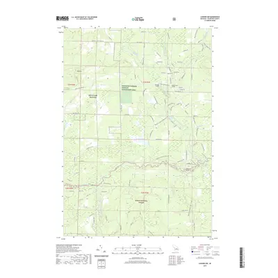
2019 Map of Luzerne NW
USGS Topo · Published 2019About this map
The North Branch Au Sable River and South Branch Au Sable River converge in this northern Michigan landscape, creating a complex network of coldwater streams and wetlands. The protected habitat of the Kirtlands Warbler Wildlife Management Area and the Huron National Forest dominate the terrain, ensuring the preservation of the jack pine plains and riparian corridors. This area is characterized by a high density of named crossings and recreational access points, including Kelloggs Bridge, McMasters Bridge, and Blonde Dam Bridge. Local relief is provided by Bald Hill, while the Shore to Shore Trail and numerous truck trails like Bucks East & West Truck Trl suggest a history of forestry and conservation management. Military interests are also present near the western border with the MTC-H Camp Grayling boundary.
Find a feature on this map
101 named features on this map. Tap any name to fly to it.
Don’t see what you’re looking for? This feature index may not catch every label — zoom into the map to look around manually.
Map Details
Editions of this 2019 Luzerne NW Map
This is the sole edition of this map. No revisions or reprints were ever made.
Other maps of this area

1949 · Lewiston
USGS Topo · 1:62,500

1949 · Otsego Lake
USGS Topo · 1:62,500

1949 · Grayling
USGS Topo · 1:62,500

1950 · Comstock Hills
USGS Topo · 1:24,000

1950 · Lovells
USGS Topo · 1:24,000

1950 · Roscommon North
USGS Topo · 1:24,000

1951 · K P Lake
USGS Topo · 1:24,000

1951 · Comstock Hills
USGS Topo · 1:24,000

1951 · Lovells
USGS Topo · 1:24,000

1951 · Wakeley Lake
USGS Topo · 1:24,000
Featured Places
- Lovells Township, MI
- Grayling Charter Township, MI
- South Branch Township, MI
- Crawford County, MI
- United States