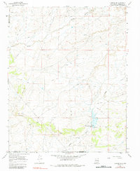
1966 Map of Lybrook SE
USGS Topo · Published 1984About this map
Ojo Socorro and the small landmark of Union anchor the southwestern corner of this mid-1960s landscape, where Sandoval, San Juan, and McKinley counties converge. The terrain is defined by a network of seasonal watercourses like Cañada Alemita and Cañada Alamos, which cut through the high desert toward the Cottonwood Flats. The industrial character of the era is visible in the spiderweb of pipelines and jeep trails that service numerous resource extraction sites, including the Werito-Martin Well and Harrison Well. Water management is central to the area's development, evidenced by the Alamos Detention Dam and its marked spillway. This survey documents a working landscape of ranching and energy infrastructure just before the more modern shifts in New Mexico's northern frontier.
Find a feature on this map
17 named features on this map. Tap any name to fly to it.
Don’t see what you’re looking for? This feature index may not catch every label — zoom into the map to look around manually.
Map Details
Editions of this 1966 Lybrook SE Map
2 editions found
Other maps of this area

1883 · Mt. Taylor
USGS Topo · 1:250,000

1886 · Mt. Taylor
USGS Topo · 1:250,000

1889 · Largo
USGS Topo · 1:250,000

1892 · Mt. Taylor
USGS Topo · 1:250,000

1895 · Largo
USGS Topo · 1:250,000

1899 · Mt. Taylor
USGS Topo · 1:250,000

1954 · Aztec
USGS Topo · 1:250,000

1958 · Aztec
USGS Topo · 1:250,000

1958 · Albuquerque
USGS Topo · 1:250,000

1960 · Pueblo Alto Trading Post
USGS Topo · 1:24,000