
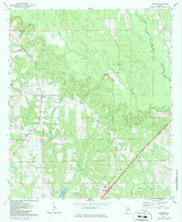
1971 Map of Lyeffion
USGS Topo · Published 1971About this map
Lyeffion and the neighboring community of Cooks Crossroads anchor this rural landscape in the early 1970s. The terrain is defined by the winding paths of the West Sepulga River and East Sepulga River, which converge to form the main Sepulga River channel. This map offers a detailed look at the social and logistical layout of the era, from the Sepulga Lookout Tower overlooking the timberlands to the network of country churches like New Hope Ch, Mt Zion Ch, and Little Pine Level Ch. In the southern portion of the quadrangle, the industrial and transport needs of the county are visible through the path of the Louisville and Nashville railroad near the small settlement of Wilcox. Genealogists may find value in the scattered cemeteries and church sites, while the presence of Lake Shirley and Duck Creek provides a clear view of the local drainage patterns as they existed before modern development.
Find a feature on this map
21 named features on this map. Tap any name to fly to it.
Don’t see what you’re looking for? This feature index may not catch every label — zoom into the map to look around manually.
Map Details
Editions of this 1971 Lyeffion Map
2 editions found
Other maps of this area

1953 · Andalusia
USGS Topo · 1:250,000

1957 · Andalusia
USGS Topo · 1:250,000

1971 · Belleville
USGS Topo · 1:24,000

1971 · Garland
USGS Topo · 1:24,000

1971 · Skinnerton
USGS Topo · 1:24,000

1971 · China
USGS Topo · 1:24,000

1971 · Bethel
USGS Topo · 1:24,000

1971 · Georgiana West
USGS Topo · 1:24,000

1982 · Evergreen
USGS Topo · 1:24,000

1982 · Old Town
USGS Topo · 1:24,000