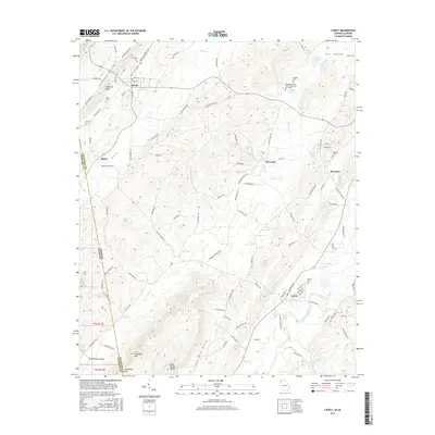
2017 Map of Lyerly
USGS Topo · Published 2017About this map
The Chattooga River winds through the southern portion of this landscape, framing a region defined by distinct ridges and valleys along the Georgia and Alabama border. The town of Lyerly serves as a primary hub in the south, while the community of Menlo sits tucked under the shadow of Shinbone Ridge to the north. Between these settlements, the topography is marked by narrow corridors like Shinbone Valley and Dry Valley, which have historically dictated the placement of roads and homesteads. Local heritage is preserved at the Pleasant Green Church Memorial Monument and scattered burial grounds including Gamble Cem and Ami Cem. The map illustrates the rural character of the area, showing the proximity of Berryton and Perennial to the various springs and creeks, such as Raccoon Cr and Alpine Cr, that drain the watershed between Dirtseller Mtn and the northern ridges.
Find a feature on this map
104 named features on this map. Tap any name to fly to it.
Don’t see what you’re looking for? This feature index may not catch every label — zoom into the map to look around manually.
Map Details
Editions of this 2017 Lyerly Map
This is the sole edition of this map. No revisions or reprints were ever made.
Other maps of this area

1886 · Ringgold
USGS Topo · 1:125,000

1886 · Rome
USGS Topo · 1:125,000

1886 · Stevenson
USGS Topo · 1:125,000

1892 · Ringgold
USGS Topo · 1:125,000

1892 · Stevenson
USGS Topo · 1:125,000

1893 · Fort Payne
USGS Topo · 1:125,000

1895 · Stevenson
USGS Topo · 1:125,000

1898 · Rome
USGS Topo · 1:125,000

1898 · Fort Payne
USGS Topo · 1:125,000

1899 · Rome
USGS Topo · 1:125,000