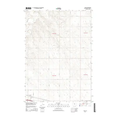
2015 Map of Lyman
USGS Topo · Published 2015About this map
The small community of Lyman anchors the southwest corner of this South Dakota landscape, situated at the intersection of local routes like Petersons Rd and 242nd St. The area is defined by the drainage of Medicine Cr, which carves through the northern township sections in a series of sharp bends and coulees. This 2015 survey illustrates a rural interior dominated by the Public Land Survey System, with a high density of section lines and gravel roads including 235th St and 324th Ave providing access to the open range. In the south, Highway 16 runs parallel to the interstate corridor, tracing the historic east-west path across the prairie. The map provides a clear record of land divisions across Townships 105 and 106 North, showing the network of avenues and streets that define Lyman County's agricultural geography.
Find a feature on this map
17 named features on this map. Tap any name to fly to it.
Don’t see what you’re looking for? This feature index may not catch every label — zoom into the map to look around manually.
Map Details
Editions of this 2015 Lyman Map
This is the sole edition of this map. No revisions or reprints were ever made.
Other maps of this area

1952 · Reliance SW
USGS Topo · 1:24,000

1952 · Reliance SE
USGS Topo · 1:24,000

1953 · Huron
USGS Topo · 1:250,000

1954 · Huron
USGS Topo · 1:250,000

1955 · Mitchell
USGS Topo · 1:250,000

1959 · Mitchell
USGS Topo · 1:250,000

1966 · Lower Brule SW
USGS Topo · 1:24,000

1966 · Joe Creek SE
USGS Topo · 1:24,000

1966 · Lower Brule
USGS Topo · 1:24,000
1978 · Lyman
USGS Topo · 1:24,000