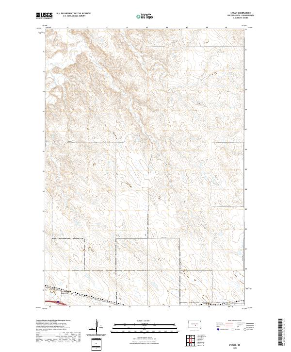
2021 Map of Lyman
USGS Topo · Published 2021About this map
Lyman sits at the southwestern edge of this South Dakota landscape, where the prairie topography is defined by the winding course of Medicine Cr. The terrain is marked by a consistent grid of rural section lines and local thoroughfares, such as Grv Rd and 241st St, which facilitate movement through the open range. This modern survey reflects the enduring structure of the Public Land Survey System, specifically detailing portions of townships t106n r74w, t106n r73w, t105n r74w, and t105n r73w. The map illustrates the sparsely settled character of Lyman County in the early 21st century, showing how the drainage of Medicine Cr dictates the local elevation contours and land use patterns.
Find a feature on this map
11 named features on this map. Tap any name to fly to it.
Don’t see what you’re looking for? This feature index may not catch every label — zoom into the map to look around manually.
Map Details
Editions of this 2021 Lyman Map
This is the sole edition of this map. No revisions or reprints were ever made.
Other maps of this area

1952 · Reliance SW
USGS Topo · 1:24,000

1952 · Reliance SE
USGS Topo · 1:24,000

1953 · Huron
USGS Topo · 1:250,000

1954 · Huron
USGS Topo · 1:250,000

1955 · Mitchell
USGS Topo · 1:250,000

1959 · Mitchell
USGS Topo · 1:250,000

1966 · Lower Brule SW
USGS Topo · 1:24,000

1966 · Joe Creek SE
USGS Topo · 1:24,000

1966 · Lower Brule
USGS Topo · 1:24,000
1978 · Lyman
USGS Topo · 1:24,000