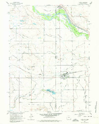
1960 Map of Lyman
USGS Topo · Published 1974About this map
The Wyoming Nebraska state line bisects this 1960 landscape, where the North Platte River carves a fertile corridor through the high plains. The settlement of Lyman serves as a central hub, anchored by the Union Pacific railroad and local infrastructure like the High Sch. To the north, the town of Henry sits near the riverbanks, where the Chicago Burlington and Quincy tracks and the Farmers Canal define the industrial and agricultural rhythm of the valley.
Find a feature on this map
32 named features on this map. Tap any name to fly to it.
Don’t see what you’re looking for? This feature index may not catch every label — zoom into the map to look around manually.
Map Details
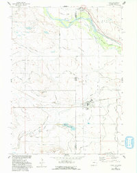
Editions of this 1960 Lyman Map
3 editions found

Other maps of this area

1896 · Patrick
USGS Topo · 1:125,000

1898 · Scotts Bluff
USGS Topo · 1:125,000

1899 · Goshen Hole
USGS Topo · 1:125,000

1899 · Whistle Creek
USGS Topo · 1:125,000

1954 · Scottsbluff
USGS Topo · 1:250,000

1954 · Torrington
USGS Topo · 1:250,000

1954 · Cheyenne
USGS Topo · 1:250,000

1955 · Alliance
USGS Topo · 1:250,000

1957 · Alliance
USGS Topo · 1:250,000

1958 · Cheyenne
USGS Topo · 1:250,000