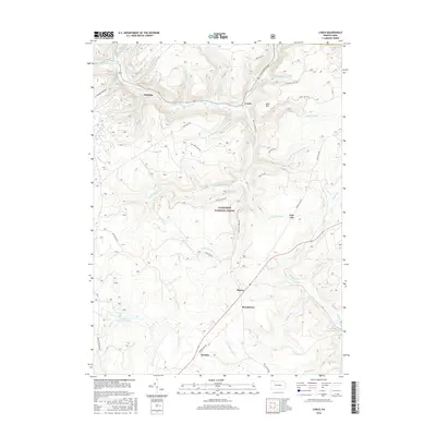
2016 Map of Lynch
USGS Topo · Published 2016About this map
Allegheny National Forest dominates the terrain of this 2016 survey, where the steep valleys of the Pennsylvania highlands are carved by a dense network of waterways. Along the northern edge, Tionesta Creek flows past the small settlements of Hastings and Lynch. The map reveals the area's industrial legacy through the presence of an Old Railroad Grade and several forest roads that likely follow historic timber or transport routes. Further south, the landscape is marked by remote locales such as Pigeon, Byromtown, and Penoke, which sit near the headwaters of Rock Run and Spring Creek. The southern portion of the quadrangle also contains Beaver Meadows Lake, a significant water feature within the forest's interior. This map is an essential resource for understanding the contemporary geography and surviving historic place names in this protected forest region.
Find a feature on this map
51 named features on this map. Tap any name to fly to it.
Don’t see what you’re looking for? This feature index may not catch every label — zoom into the map to look around manually.
Map Details
Editions of this 2016 Lynch Map
This is the sole edition of this map. No revisions or reprints were ever made.
Other maps of this area

1918 · Loleta
USGS Topo · 1:62,500

1934 · Kane
USGS Topo · 1:48,000

1935 · Sheffield
USGS Topo · 1:48,000

1936 · Marienville
USGS Topo · 1:48,000

1939 · Kane
USGS Topo · 1:62,500

1940 · Hallton
USGS Topo · 1:48,000

1941 · Sheffield
USGS Topo · 1:62,500

1941 · Marienville
USGS Topo · 1:62,500

1943 · Hallton
USGS Topo · 1:62,500

1947 · Cherry Grove
USGS Topo · 1:24,000
Featured Places
- Sheffield Township, PA
- Jenks Township, PA
- Howe Township, PA
- Pigeon, Howe Township
- Hastings, Howe Township