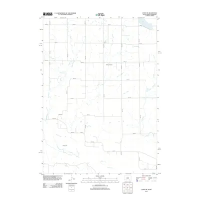
2012 Map of Lynch NE
USGS Topo · Published 2012About this map
The Missouri River winds along the southern edge of this landscape, defining a riparian corridor that includes Willow Bar and the lowlands of Tobacco Bottom. This section of Charles Mix County is primarily organized by a strict township grid, though the straight lines of section roads like 393rd Ave and 306th St are frequently interrupted by the wandering paths of Slaughter Cr and Mosquito Cr. In the northeast corner, the isolated White Lake sits at the edge of the survey area, while Spring Cr drains the eastern territory. The map illustrates a rural expanse where named roads such as Eggers Rd and Count Rd 2 provide local access between creek-fed pastures and the river plain, reflecting the enduring agricultural character of the South Dakota-Nebraska border region.
Find a feature on this map
25 named features on this map. Tap any name to fly to it.
Don’t see what you’re looking for? This feature index may not catch every label — zoom into the map to look around manually.
Map Details
Editions of this 2012 Lynch NE Map
This is the sole edition of this map. No revisions or reprints were ever made.
Other maps of this area

1950 · Verdel
USGS Topo · 1:24,000

1950 · Lynch
USGS Topo · 1:24,000

1950 · Monowi
USGS Topo · 1:24,000

1952 · Monowi
USGS Topo · 1:24,000

1955 · Mitchell
USGS Topo · 1:250,000

1955 · O'Neill
USGS Topo · 1:250,000

1959 · O'Neill
USGS Topo · 1:250,000

1959 · Mitchell
USGS Topo · 1:250,000

1964 · Wagner
USGS Topo · 1:24,000

1964 · Lynch NE
USGS Topo · 1:24,000