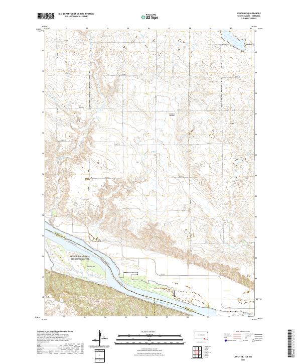
2021 Map of Lynch NE
USGS Topo · Published 2021About this map
The Missouri National Recreation River and the Missouri Wild and Scenic River define the southern border of this region, where the Missouri River carves a complex boundary between South Dakota and Nebraska. The landscape transitions from the river bottomlands at Tobacco Bottom and Willow Bar to the higher plains of Charles Mix County. To the north, the Charles Mix County Waterfowl Production Area surrounds White Lake, preserving vital wetlands in this drainage basin. The area is characterized by a network of seasonal streams, including Slaughter Cr, Mosquito Cr, and Spring Cr, which have historically shaped the agricultural section lines and road placement. The Upper Missouri River Trl follows the northern bank, offering a glimpse into the modern management of this historic river corridor.
Find a feature on this map
37 named features on this map. Tap any name to fly to it.
Don’t see what you’re looking for? This feature index may not catch every label — zoom into the map to look around manually.
Map Details
Editions of this 2021 Lynch NE Map
This is the sole edition of this map. No revisions or reprints were ever made.
Other maps of this area

1950 · Verdel
USGS Topo · 1:24,000

1950 · Lynch
USGS Topo · 1:24,000

1950 · Monowi
USGS Topo · 1:24,000

1952 · Monowi
USGS Topo · 1:24,000

1955 · Mitchell
USGS Topo · 1:250,000

1955 · O'Neill
USGS Topo · 1:250,000

1959 · O'Neill
USGS Topo · 1:250,000

1959 · Mitchell
USGS Topo · 1:250,000

1964 · Wagner
USGS Topo · 1:24,000

1964 · Lynch NE
USGS Topo · 1:24,000