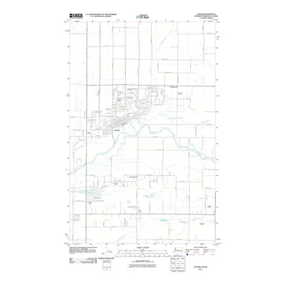
2011 Map of Lynden
USGS Topo · Published 2011About this map
The Nooksack River winds through this region of Whatcom County, defining a landscape shaped by both natural waterways and a meticulously planned irrigation network. The city of Lynden sits at the heart of the map, showing a dense residential grid and key local infrastructure like the Lynden Post Office and Lynden Airport. Surrounding the urban center, the land is marked by significant agricultural and drainage features, including the Mormon Ditch and Fishtrap Creek.
Find a feature on this map
134 named features on this map. Tap any name to fly to it.
Don’t see what you’re looking for? This feature index may not catch every label — zoom into the map to look around manually.
Map Details
Editions of this 2011 Lynden Map
This is the sole edition of this map. No revisions or reprints were ever made.
Other maps of this area

1906 · Sumas
USGS Topo · 1:62,500

1907 · Blaine
USGS Topo · 1:62,500

1908 · Sumas
USGS Topo · 1:62,500

1952 · Bertrand Creek
USGS Topo · 1:24,000

1952 · Lynden
USGS Topo · 1:24,000

1952 · Lawrence
USGS Topo · 1:24,000

1952 · Sumas
USGS Topo · 1:24,000

1952 · Ferndale
USGS Topo · 1:24,000

1952 · Blaine
USGS Topo · 1:62,500

1954 · Bellingham North
USGS Topo · 1:24,000