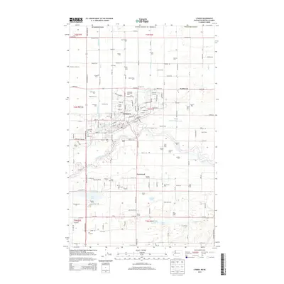
2014 Map of Lynden
USGS Topo · Published 2014About this map
Lynden and the surrounding Whatcom County lowlands are defined by a dense network of family-owned agricultural operations and water management systems. The town center is bordered by the Nooksack River to the south and Pepin Cr to the north, with the Lynden Airport and the Homestead Farms Golf Resort marking the community's northern expansion. The landscape is notably organized by numerous dairies and farms, such as Edaleen Dairy, Vande Garde Dairy, and Plagerman Farms, reflecting the region's enduring commitment to dairy production.
Find a feature on this map
163 named features on this map. Tap any name to fly to it.
Don’t see what you’re looking for? This feature index may not catch every label — zoom into the map to look around manually.
Map Details
Editions of this 2014 Lynden Map
This is the sole edition of this map. No revisions or reprints were ever made.
Other maps of this area

1906 · Sumas
USGS Topo · 1:62,500

1907 · Blaine
USGS Topo · 1:62,500

1908 · Sumas
USGS Topo · 1:62,500

1952 · Bertrand Creek
USGS Topo · 1:24,000

1952 · Lynden
USGS Topo · 1:24,000

1952 · Lawrence
USGS Topo · 1:24,000

1952 · Sumas
USGS Topo · 1:24,000

1952 · Ferndale
USGS Topo · 1:24,000

1952 · Blaine
USGS Topo · 1:62,500

1954 · Bellingham North
USGS Topo · 1:24,000