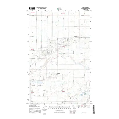
2017 Map of Lynden
USGS Topo · Published 2017About this map
Lynden serves as the focal point of this northern Washington landscape, situated along the north bank of the Nooksack River. The map reveals a highly structured agricultural and residential grid, characterized by numerous drainage features such as Double Ditch, Fishtrap Cr, and the Mormon Ditch which manage the low-lying valley floor. The town's infrastructure is anchored by the Lynden Municipal Airport Jansen Field, while the surrounding countryside is dotted with small outlying settlements like Northwood and Greenwood. Genealogists will find significant value in the distribution of local burial sites, including Monumenta Cem and Lynden Cem on the west side of the city, Jobe Cem to the northeast, and Greenwood Cem to the south. Natural landmarks such as Wiser Lake and Fountain Lake break the rectilinear pattern of the section lines and farm roads.
Find a feature on this map
105 named features on this map. Tap any name to fly to it.
Don’t see what you’re looking for? This feature index may not catch every label — zoom into the map to look around manually.
Map Details
Editions of this 2017 Lynden Map
This is the sole edition of this map. No revisions or reprints were ever made.
Other maps of this area

1906 · Sumas
USGS Topo · 1:62,500

1907 · Blaine
USGS Topo · 1:62,500

1908 · Sumas
USGS Topo · 1:62,500

1952 · Bertrand Creek
USGS Topo · 1:24,000

1952 · Lynden
USGS Topo · 1:24,000

1952 · Lawrence
USGS Topo · 1:24,000

1952 · Sumas
USGS Topo · 1:24,000

1952 · Ferndale
USGS Topo · 1:24,000

1952 · Blaine
USGS Topo · 1:62,500

1954 · Bellingham North
USGS Topo · 1:24,000