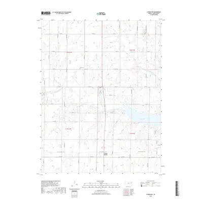
2018 Map of Lyndon NW
USGS Topo · Published 2018About this map
Lyndon Station serves as a focal point in this eastern Kansas landscape, situated near the intersection of the Flint Hills Nature Trail and Willow Brook. This 2018 survey captures a terrain defined by its complex drainage network, where Dragoon Creek and Hundred and Ten Mile Creek wind toward the western reaches of Pomona Lake. The map reveals a rural structure organized by a rigorous section line road grid, including S Adams Rd and S Lewelling Rd, which connect scattered homesteads and local landmarks. To the north, Highland Cem stands as a point of interest for genealogists, while the Pomona Lake Airport indicates the modern infrastructure supporting this recreational and agricultural region. The abundance of named waterways like Popcorn Cr and Opossum Cr illustrates the fine-grained hydrography that has shaped land use and property boundaries in Osage County for generations.
Find a feature on this map
49 named features on this map. Tap any name to fly to it.
Don’t see what you’re looking for? This feature index may not catch every label — zoom into the map to look around manually.
Map Details
Editions of this 2018 Lyndon NW Map
This is the sole edition of this map. No revisions or reprints were ever made.
Other maps of this area

1889 · Burlingame
USGS Topo · 1:125,000

1894 · Burlingame
USGS Topo · 1:125,000

1947 · Lawrence
USGS Topo · 1:250,000

1950 · Lawrence
USGS Topo · 1:250,000

1952 · Burlingame
USGS Topo · 1:24,000

1955 · Overbrook
USGS Topo · 1:24,000

1955 · Carbondale
USGS Topo · 1:24,000

1956 · Lawrence
USGS Topo · 1:250,000

1961 · Lawrence
USGS Topo · 1:250,000
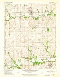
1965 · Lyndon
USGS Topo · 1:24,000