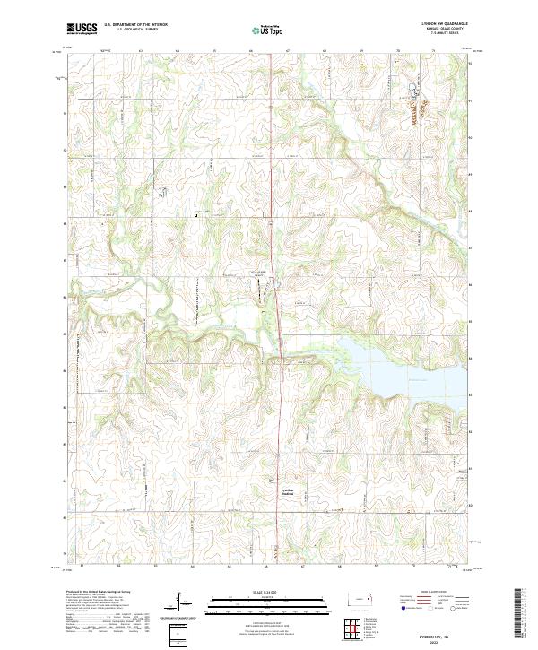
2022 Map of Lyndon NW
USGS Topo · Published 2022About this map
Pomona Lake dominates the central landscape of this northwest Lyndon quadrangle, its eastern waters fed by the winding Dragoon Creek. The surrounding terrain is defined by a dense network of tributaries, including Hundred and Ten Mile Creek and the curiously named Popcorn Cr. These watercourses dictate the rural settlement patterns, as local roads like S Lewelling Rd and S California Rd navigate the low ridges between drainage basins.
Find a feature on this map
51 named features on this map. Tap any name to fly to it.
Don’t see what you’re looking for? This feature index may not catch every label — zoom into the map to look around manually.
Map Details
Editions of this 2022 Lyndon NW Map
This is the sole edition of this map. No revisions or reprints were ever made.
Other maps of this area

1889 · Burlingame
USGS Topo · 1:125,000

1894 · Burlingame
USGS Topo · 1:125,000

1947 · Lawrence
USGS Topo · 1:250,000

1950 · Lawrence
USGS Topo · 1:250,000

1952 · Burlingame
USGS Topo · 1:24,000

1955 · Overbrook
USGS Topo · 1:24,000

1955 · Carbondale
USGS Topo · 1:24,000

1956 · Lawrence
USGS Topo · 1:250,000

1961 · Lawrence
USGS Topo · 1:250,000
1965 · Lyndon
USGS Topo · 1:24,000