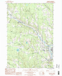
1986 Map of Lyndonville
USGS Topo · Published 1987About this map
Lyndonville and the surrounding townships of Caledonia County are defined here by a series of north-south ridges and the waters of the Passumpsic River. The landscape in the mid-1980s reveals a mix of academic life at Lyndon State College and the rural character of high terrain like Pudding Hill and Mathewson Hill. Dense woodlands of the Mathewson State Forest cover the northern heights, while the valley floor supports the village centers and the Caledonia County Airport.
Find a feature on this map
42 named features on this map. Tap any name to fly to it.
Don’t see what you’re looking for? This feature index may not catch every label — zoom into the map to look around manually.
Map Details
Editions of this 1986 Lyndonville Map
2 editions found
Other maps of this area

1931 · Littleton
USGS Topo · 1:62,500

1932 · Littleton
USGS Topo · 1:48,000

1935 · Littleton
USGS Topo · 1:62,500

1935 · Lyndonville
USGS Topo · 1:48,000

1938 · St. Johnsbury
USGS Topo · 1:48,000

1939 · Lyndonville
USGS Topo · 1:62,500

1943 · St. Johnsbury
USGS Topo · 1:62,500
1949 · St. Johnsbury
USGS Topo · 1:62,500

1950 · Lake Champlain
USGS Topo · 1:250,000

1950 · Lewiston
USGS Topo · 1:250,000