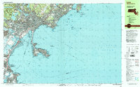
1997 Map of Lynn
USGS Topo · Published 1999About this map
The rocky North Shore coastline defines this area of Massachusetts, dominated by the urban center of Lynn and its sprawling Lynn Woods Reservation. To the north and west, the interior landscape includes prominent high points like Mt Moriah and the historic Dungeon Rock, alongside significant water bodies including Walden Pond and Breeds Pond. The map reveals a dense network of neighborhood schools and religious institutions, such as Classical High Sch and St Marys Sch, reflecting the community's established social fabric.
Find a feature on this map
190 named features on this map. Tap any name to fly to it.
Don’t see what you’re looking for? This feature index may not catch every label — zoom into the map to look around manually.
Map Details
Editions of this 1997 Lynn Map
This is the sole edition of this map. No revisions or reprints were ever made.
Other maps of this area

1886 · Gloucester
USGS Topo · 1:62,500

1886 · Lawrence
USGS Topo · 1:62,500

1888 · Gloucester
USGS Topo · 1:62,500

1888 · Lawrence
USGS Topo · 1:62,500

1888 · Salem
USGS Topo · 1:62,500

1892 · Boston Bay
USGS Topo · 1:62,500

1893 · Salem
USGS Topo · 1:62,500

1893 · Boston
USGS Topo · 1:62,500

1893 · Lawrence
USGS Topo · 1:62,500

1893 · Gloucester
USGS Topo · 1:62,500