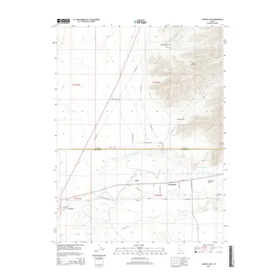
2014 Map of Lynndyl East
USGS Topo · Published 2014About this map
The Sevier River winds through this West Central Utah landscape, marking a vital corridor of irrigation and settlement in Millard County. The towns of Leamington and Lynndyl serve as primary hubs, connected by a network of canals including the Leamington Canal, Central Utah Canal, and McIntyre Canal that define the agricultural character of the valley floor. To the north, the terrain rises sharply into the Gilson Mountains, cut by deep drainages like Broad Canyon and Long Canyon.
Find a feature on this map
43 named features on this map. Tap any name to fly to it.
Don’t see what you’re looking for? This feature index may not catch every label — zoom into the map to look around manually.
Map Details
Editions of this 2014 Lynndyl East Map
This is the sole edition of this map. No revisions or reprints were ever made.
Other maps of this area

1885 · Sevier Desert
USGS Topo · 1:250,000

1951 · Oak City
USGS Topo · 1:62,500

1952 · Scipio North
USGS Topo · 1:62,500

1953 · Delta
USGS Topo · 1:250,000

1958 · Delta
USGS Topo · 1:250,000

1962 · Delta
USGS Topo · 1:250,000

1962 · Lynndyl
USGS Topo · 1:62,500

1967 · Champlin Peak
USGS Topo · 1:24,000
1967 · Jericho
USGS Topo · 1:24,000

1979 · Lynndyl
USGS Topo · 1:100,000