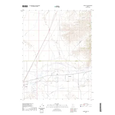
2023 Map of Lynndyl East
USGS Topo · Published 2023About this map
The Sevier River carves a critical path through this landscape, defining the agricultural and settlement patterns where the Juab and Millard county lines meet. The desert terrain is heavily modified by an intricate network of irrigation infrastructure, including the Central Utah Canal, McIntyre Canal, and Leamington Canal, which support the small communities of Leamington and Lynndyl. To the east, the Gilson Mountains rise sharply, cut by the deep recess of Leamington Canyon and the smaller Broad Canyon. This area reflects a long-standing reliance on managed water systems to sustain life at the mountain's base. Researchers will find the Lynndyl Cem and Leamington Cem clearly marked, along with the former rail-adjacent settlement of Mack, providing essential coordinates for local genealogical and historical study of this rural corridor.
Find a feature on this map
29 named features on this map. Tap any name to fly to it.
Don’t see what you’re looking for? This feature index may not catch every label — zoom into the map to look around manually.
Map Details
Editions of this 2023 Lynndyl East Map
This is the sole edition of this map. No revisions or reprints were ever made.
Other maps of this area

1885 · Sevier Desert
USGS Topo · 1:250,000

1951 · Oak City
USGS Topo · 1:62,500

1952 · Scipio North
USGS Topo · 1:62,500

1953 · Delta
USGS Topo · 1:250,000

1958 · Delta
USGS Topo · 1:250,000

1962 · Delta
USGS Topo · 1:250,000

1962 · Lynndyl
USGS Topo · 1:62,500

1967 · Champlin Peak
USGS Topo · 1:24,000
1967 · Jericho
USGS Topo · 1:24,000

1979 · Lynndyl
USGS Topo · 1:100,000