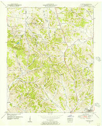
1951 Map of Lynnville
USGS Topo · Published 1956About this map
Elk Ridge dominates the center of this 1951 survey, creating a dissected landscape of deep hollows and high points like Perry Hill and Kansas Hill. The area's settlement pattern is defined by rural communities connected by the Bee Line Highway and Mooresville Pike. In the southern reaches, Lynnville serves as a primary center of activity, with its residential streets and the nearby Lynnwood Cemetery.
Find a feature on this map
69 named features on this map. Tap any name to fly to it.
Don’t see what you’re looking for? This feature index may not catch every label — zoom into the map to look around manually.
Map Details
Editions of this 1951 Lynnville Map
2 editions found
Other maps of this area

1901 · Colombia
USGS Topo · 1:125,000

1936 · Sandy Hook
USGS Topo · 1:24,000

1936 · Milky Way
USGS Topo · 1:24,000

1936 · Campbellsville
USGS Topo · 1:24,000

1936 · Brick Church
USGS Topo · 1:24,000

1936 · Campbells Station
USGS Topo · 1:24,000

1936 · Mount Pleasant
USGS Topo · 1:24,000

1936 · Glendale
USGS Topo · 1:24,000

1936 · Columbia
USGS Topo · 1:24,000

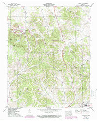
1936 · Lynnville
USGS Topo · 1:24,000