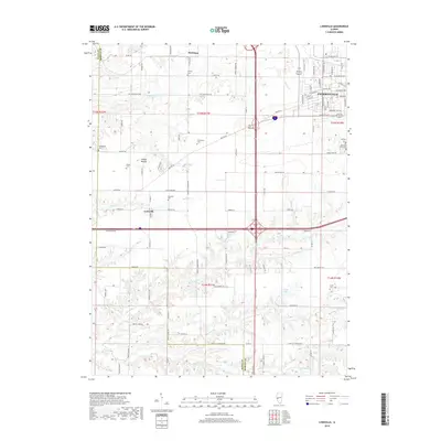
2018 Map of Lynnville
USGS Topo · Published 2018About this map
Jacksonville anchors the northeastern corner of this West-Central Illinois survey, where suburban development meets the agricultural expanse of Morgan County. The landscape is defined by its subtle glacial topography, highlighted by distinctive rises such as The Mound and Allison Mound. A network of rural cemeteries, including Liberty Cem, Campbell Cem, and Richardson Cem, provides valuable reference points for genealogists tracking early families in the region. The map captures the meeting of older transport routes like Old Rte 36 with modern infrastructure, while the village of Lynnville remains a central point of the rural community. To the south, the terrain becomes more varied as it descends into the drainages of Big Sandy Cr and Brushy Fork, where woodlots break the grid of section lines and farm roads like Leach Farm Rd.
Find a feature on this map
88 named features on this map. Tap any name to fly to it.
Don’t see what you’re looking for? This feature index may not catch every label — zoom into the map to look around manually.
Map Details
Editions of this 2018 Lynnville Map
This is the sole edition of this map. No revisions or reprints were ever made.
Other maps of this area

1924 · Winchester
USGS Topo · 1:48,000

1926 · Winchester
USGS Topo · 1:62,500

1929 · Arenzville
USGS Topo · 1:62,500

1932 · Arenzville
USGS Topo · 1:62,500

1932 · Jacksonville
USGS Topo · 1:62,500

1932 · Virginia
USGS Topo · 1:62,500

1936 · Virginia
USGS Topo · 1:62,500

1937 · Jacksonville
USGS Topo · 1:62,500

1948 · Quincy
USGS Topo · 1:250,000

1956 · Quincy
USGS Topo · 1:250,000