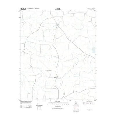
2012 Map of Lynville
USGS Topo · Published 2012About this map
Joe Williams Naval Outlying Field occupies a prominent portion of this Kemper County landscape, serving as a distinct military landmark amid the rural terrain. The area is characterized by small, scattered settlements like Lynville and Bluff Springs, connected by a network of family-named roads such as Lewis Cook Rd and Nell Burnett Rd. This 2012 survey illustrates the enduring nature of local heritage through its numerous cemeteries, including Pleasant Springs Cem and Smyrna Cem, which are often the primary remaining indicators of early community centers. The geography is defined by the winding Sucarnoochee River and various watercourses like Bendix Cr and Land Cr, showing how the natural drainage patterns have historically influenced the placement of farms and homesteads in this part of Mississippi.
Find a feature on this map
60 named features on this map. Tap any name to fly to it.
Don’t see what you’re looking for? This feature index may not catch every label — zoom into the map to look around manually.
Map Details
Editions of this 2012 Lynville Map
This is the sole edition of this map. No revisions or reprints were ever made.
Other maps of this area

1953 · Meridian
USGS Topo · 1:250,000

1957 · Meridian
USGS Topo · 1:250,000

1962 · House
USGS Topo · 1:24,000

1962 · Lynville
USGS Topo · 1:24,000

1962 · Vernon
USGS Topo · 1:24,000

1962 · Owl Creek
USGS Topo · 1:24,000

1962 · Lauderdale NW
USGS Topo · 1:24,000

1962 · Preston
USGS Topo · 1:24,000

1962 · Moscow
USGS Topo · 1:24,000

1963 · De Kalb
USGS Topo · 1:24,000