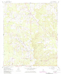
1962 Map of Lynville
USGS Topo · Published 1982About this map
Naval Auxiliary Air Station Bravo Field dominates the central landscape of this Kemper County quadrangle, situated near the headwaters of Bogue Chitto Creek. This 1962 survey, updated with 1980 aerial revisions, captures a network of small agricultural settlements and community anchors in the post-war era. The terrain is defined by the drainage systems of Bendix Creek and Cow Creek, where family and community landmarks like Kellis Store and Lynville provided local services.
Find a feature on this map
21 named features on this map. Tap any name to fly to it.
Don’t see what you’re looking for? This feature index may not catch every label — zoom into the map to look around manually.
Map Details
Editions of this 1962 Lynville Map
3 editions found
Other maps of this area

1953 · Meridian
USGS Topo · 1:250,000

1957 · Meridian
USGS Topo · 1:250,000

1962 · House
USGS Topo · 1:24,000

1962 · Lynville
USGS Topo · 1:24,000

1962 · Vernon
USGS Topo · 1:24,000

1962 · Owl Creek
USGS Topo · 1:24,000

1962 · Lauderdale NW
USGS Topo · 1:24,000

1962 · Preston
USGS Topo · 1:24,000

1962 · Moscow
USGS Topo · 1:24,000

1963 · De Kalb
USGS Topo · 1:24,000