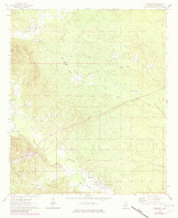
1963 Map of Townsend
USGS Topo · Published 1982About this map
The community of Townsend serves as a focal point in this portion of Kemper County, situated near the intersection of several local watercourses including Old Railroad Grade Creek and Sucarnoochee Creek. The landscape is defined by its drainage patterns, with numerous named branches such as Straight Branch, Pole Branch, and Hamilton Branch feeding into the larger creek systems. Cultural landmarks are scattered throughout the region, including Antioch Ch and Stonewall Ch, which along with Felton Cem and Cherry Cem, provide significant markers for genealogical research.
Find a feature on this map
21 named features on this map. Tap any name to fly to it.
Don’t see what you’re looking for? This feature index may not catch every label — zoom into the map to look around manually.
Map Details
Editions of this 1963 Townsend Map
2 editions found
Other maps of this area

1953 · Meridian
USGS Topo · 1:250,000

1957 · Meridian
USGS Topo · 1:250,000

1962 · Lauderdale NW
USGS Topo · 1:24,000

1962 · Oak Grove
USGS Topo · 1:24,000

1962 · Shuqualak
USGS Topo · 1:24,000

1963 · De Kalb
USGS Topo · 1:24,000

1963 · Townsend
USGS Topo · 1:24,000

1963 · Gholson
USGS Topo · 1:24,000

1965 · Meridian
USGS Topo · 1:250,000

1973 · Scooba
USGS Topo · 1:24,000