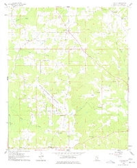
1962 Map of Lynville
USGS Topo · Published 1977About this map
The Naval Auxiliary Air Station Bravo Field dominates the central landscape of this Kemper County region, cutting a diagonal swath through the rural terrain of East Mississippi. Mapped in 1962, the sheet documents a traditional agrarian community structured around local landmarks like Kellis Store and the settlement of Lynville. The area's social fabric is clearly visible through a dense network of country churches and family burial grounds, including Clarks Chapel, Mellen Ch, and Shepard Ch Cem.
Find a feature on this map
23 named features on this map. Tap any name to fly to it.
Don’t see what you’re looking for? This feature index may not catch every label — zoom into the map to look around manually.
Map Details
Editions of this 1962 Lynville Map
3 editions found
Other maps of this area

1953 · Meridian
USGS Topo · 1:250,000

1957 · Meridian
USGS Topo · 1:250,000

1962 · House
USGS Topo · 1:24,000

1962 · Lynville
USGS Topo · 1:24,000

1962 · Vernon
USGS Topo · 1:24,000

1962 · Owl Creek
USGS Topo · 1:24,000

1962 · Lauderdale NW
USGS Topo · 1:24,000

1962 · Preston
USGS Topo · 1:24,000

1962 · Moscow
USGS Topo · 1:24,000

1963 · De Kalb
USGS Topo · 1:24,000