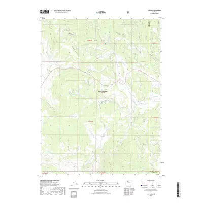
2019 Map of Lynx Pass
USGS Topo · Published 2019About this map
Lynx Pass serves as a central waypoint in this high-elevation landscape within the Routt National Forest, marking the continental divide between the Colorado and Yampa River drainages. The area is defined by its complex water management and natural hydrology, featuring several upland catchments including Tonier Gulch Reservoir, Morris Reservoir, and Bulkley Reservoir. A distinctive network of forest routes, such as the Shoe & Stocking road, weaves through the timber and meadows of Long Park and Deadman Park.
Find a feature on this map
36 named features on this map. Tap any name to fly to it.
Don’t see what you’re looking for? This feature index may not catch every label — zoom into the map to look around manually.
Map Details
Editions of this 2019 Lynx Pass Map
This is the sole edition of this map. No revisions or reprints were ever made.
Other maps of this area

1954 · Craig
USGS Topo · 1:250,000

1956 · Gore Pass
USGS Topo · 1:62,500

1957 · Craig
USGS Topo · 1:250,000

1957 · Leadville
USGS Topo · 1:250,000

1958 · Craig
USGS Topo · 1:250,000

1959 · Leadville
USGS Topo · 1:250,000

1960 · Leadville
USGS Topo · 1:250,000

1960 · Craig
USGS Topo · 1:250,000

1962 · Leadville
USGS Topo · 1:250,000

1962 · Craig
USGS Topo · 1:250,000