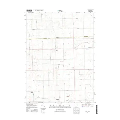
2013 Map of Lyons
USGS Topo · Published 2013About this map
The borderlands between Lenawee and Fulton counties are defined by a grid of rural highways and a series of slow-moving waterways. At the center of this landscape sits Lyons, a hub at the junction of W Morenci St and Lyons Hwy. The surrounding agricultural tracts are punctuated by small hamlets like Seward to the east and Winameg to the south. Local history and genealogy are anchored by several burial grounds, including Rose Hill Cem, Lyons Cem, and Edgar Cem. A subtle drainage network characterizes the terrain, with Bear Cr and Little Bear Cr flowing through the northern sections, while Tenmile Cr and Bad Cr cross the lower reaches. This survey provides a clear view of the transition from the Michigan state line into northern Ohio, showing the persistent 19th-century township and section structure that continues to shape land use in the modern era.
Find a feature on this map
98 named features on this map. Tap any name to fly to it.
Don’t see what you’re looking for? This feature index may not catch every label — zoom into the map to look around manually.
Map Details
Editions of this 2013 Lyons Map
This is the sole edition of this map. No revisions or reprints were ever made.
Other maps of this area

1911 · Wauseon
USGS Topo · 1:62,500

1911 · Swanton
USGS Topo · 1:62,500

1913 · Wauseon
USGS Topo · 1:62,500

1914 · Swanton
USGS Topo · 1:62,500

1939 · Blissfield
USGS Topo · 1:62,500

1941 · Blissfield
USGS Topo · 1:62,500

1943 · Wauseon
USGS Topo · 1:62,500

1953 · Fort Wayne
USGS Topo · 1:250,000

1956 · Fort Wayne
USGS Topo · 1:250,000

1956 · Toledo
USGS Topo · 1:250,000