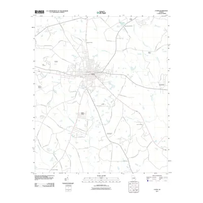
2011 Map of Lyons
USGS Topo · Published 2011About this map
The town of Lyons serves as the focal point of this Toombs County landscape, showing a structured grid of streets anchored by the Lyons Post Office. To the southwest, the uniquely named settlement of Santa Claus appears along the highway corridor, while the outlier community of Ponderosa sits to the east. The terrain is defined by a dendritic network of waterways, including Swift Creek and Little Rocky Creek, which drain toward the larger Pendleton Creek basin.
Find a feature on this map
67 named features on this map. Tap any name to fly to it.
Don’t see what you’re looking for? This feature index may not catch every label — zoom into the map to look around manually.
Map Details
Editions of this 2011 Lyons Map
This is the sole edition of this map. No revisions or reprints were ever made.
Other maps of this area

1957 · Macon
USGS Topo · 1:250,000

1958 · Macon
USGS Topo · 1:250,000

1964 · Macon
USGS Topo · 1:250,000

1970 · Cobbtown
USGS Topo · 1:24,000

1970 · Johnson Corner
USGS Topo · 1:24,000

1970 · Alston
USGS Topo · 1:24,000

1970 · Oak Park SW
USGS Topo · 1:24,000

1970 · Vidalia
USGS Topo · 1:24,000

1970 · Ohoopee
USGS Topo · 1:24,000

1970 · Reidsville West
USGS Topo · 1:24,000