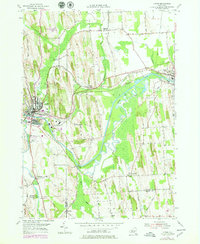
1953 Map of Lyons
USGS Topo · Published 1979About this map
The industrial and transport corridors of Wayne County are defined here by the winding Clyde River and the parallel path of the Erie Canal. Centered on Lyons, the map illustrates a landscape shaped by water and rail, where the Conrail lines intersect with historic water routes. The village of Clyde anchors the eastern edge, while smaller settlements like Lock Berlin and Fergusons Corners dot the agricultural uplands. Of particular interest to genealogists are the numerous burial grounds, including Elmwood Cem, St Johns Cem, and Rural Cem. The southern reach of the map transitions into the marshy lowlands near Marengo and the Canandaigua Outlet, showing the complex drainage systems and brooks that fed the regional economy during this mid-century period.
Find a feature on this map
56 named features on this map. Tap any name to fly to it.
Don’t see what you’re looking for? This feature index may not catch every label — zoom into the map to look around manually.
Map Details
Editions of this 1953 Lyons Map
3 editions found
Other maps of this area

1899 · Palmyra
USGS Topo · 1:62,500

1902 · Geneva
USGS Topo · 1:62,500

1902 · Clyde
USGS Topo · 1:62,500

1902 · Phelps
USGS Topo · 1:62,500

1902 · Palmyra
USGS Topo · 1:62,500

1943 · Lyons
USGS Topo · 1:31,680

1943 · Geneva North
USGS Topo · 1:31,680

1943 · Phelps
USGS Topo · 1:31,680

1943 · Savannah
USGS Topo · 1:31,680

1943 · Sodus
USGS Topo · 1:31,680