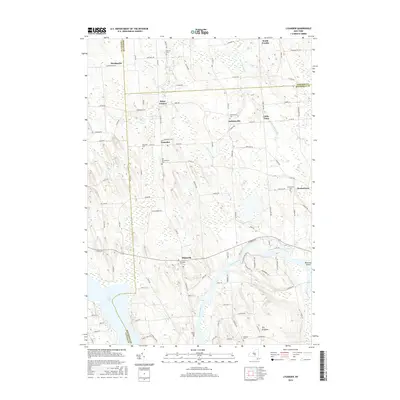
2016 Map of Lysander
USGS Topo · Published 2016About this map
Plainville and the namesake settlement of Lysander anchor this landscape where the boundaries of Onondaga, Cayuga, and Oswego counties converge. The geography is defined by the winding course of the Seneca River, which flows past Maloney Island and feeds into the eastern reaches of Cross Lake. A dense network of rural roads, such as Co Rte 8 and Co Line Rd, connects small crossroads and farming hamlets like Baird Corners, Floridaville, and Little Utica.
Find a feature on this map
102 named features on this map. Tap any name to fly to it.
Don’t see what you’re looking for? This feature index may not catch every label — zoom into the map to look around manually.
Map Details
Editions of this 2016 Lysander Map
This is the sole edition of this map. No revisions or reprints were ever made.
Other maps of this area

1900 · Baldwinsville
USGS Topo · 1:62,500

1900 · Oswego
USGS Topo · 1:62,500

1900 · Fulton
USGS Topo · 1:62,500

1902 · Weedsport
USGS Topo · 1:62,500

1943 · Jordan
USGS Topo · 1:31,680

1943 · Lysander
USGS Topo · 1:31,680

1943 · Cato
USGS Topo · 1:31,680

1943 · Pennellville
USGS Topo · 1:31,680

1943 · Hannibal
USGS Topo · 1:31,680

1943 · Weedsport
USGS Topo · 1:31,680