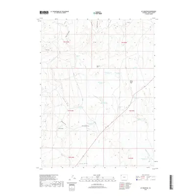
2019 Map of M F Mountain
USGS Topo · Published 2019About this map
M F Mtn dominates this portion of Moffat County, surrounded by a complex system of drainage draws and high-altitude water management features. The landscape is defined by the flow of Wolf Cr and the Middle Fork Wolf Cr, which feed several early 21st-century water storage sites including Mancos Reservoir Number 3 and Baking Powder Reservoir. These reservoirs, along with Wolf Creek Spring and Wild Horse Spring, illustrate the critical importance of water rights and management in this high-country environment. Notable landmarks such as Petes Post and Baking Powder Ridge rise above the surrounding terrain, while Maverick Flats and The Sloughs indicate varied topography ranging from level basins to wetland depressions. The presence of Co RD 16 and other county routes provides the primary access through this high-desert ranching and grazing land.
Find a feature on this map
37 named features on this map. Tap any name to fly to it.
Don’t see what you’re looking for? This feature index may not catch every label — zoom into the map to look around manually.
Map Details
Editions of this 2019 M F Mountain Map
This is the sole edition of this map. No revisions or reprints were ever made.
Other maps of this area

1907 · Rangely
USGS Topo · 1:125,000

1907 · White River
USGS Topo · 1:125,000

1910 · White River
USGS Topo · 1:125,000

1910 · Rangely
USGS Topo · 1:125,000

1954 · Vernal
USGS Topo · 1:250,000

1958 · Vernal
USGS Topo · 1:250,000

1960 · Vernal
USGS Topo · 1:250,000

1960 · Elk Springs
USGS Topo · 1:62,500

1962 · Cactus Reservoir
USGS Topo · 1:24,000
1962 · Divide Creek
USGS Topo · 1:24,000