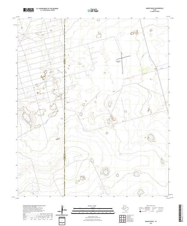
2022 Map of Mabee Ranch
USGS Topo · Published 2022About this map
The Andrews Co and Martin Co line bisects this modern landscape in West Texas, characterized by the open spaces of the Permian Basin. This ranching and energy-producing region features the Mabee Ranch Airport, a private aviation facility serving the expansive local landholdings. Transport through the area is defined by the straight lines of 349, which runs through the eastern portion of the sheet, supplemented by local routes such as Prc 1100 and Co Rd 3200. The topographic data highlights subtle elevation changes across the plains, illustrating the drainage patterns and the network of roads required to maintain operations in this sparse environment. The presence of the county boundary and the ranch airport suggests a landscape defined by large-scale property management and the logistics of remote West Texas industry.
Find a feature on this map
5 named features on this map. Tap any name to fly to it.
Don’t see what you’re looking for? This feature index may not catch every label — zoom into the map to look around manually.
Map Details
Editions of this 2022 Mabee Ranch Map
This is the sole edition of this map. No revisions or reprints were ever made.
Other maps of this area

1954 · Hobbs
USGS Topo · 1:250,000

1958 · Hobbs
USGS Topo · 1:250,000

1965 · Northeast Midland
USGS Topo · 1:24,000

1966 · Mabee Ranch
USGS Topo · 1:24,000

1966 · Flynt Ranch
USGS Topo · 1:24,000

1966 · Bird Ranch
USGS Topo · 1:24,000

1966 · North Curtis Ranch
USGS Topo · 1:24,000

1966 · Northwest Midland
USGS Topo · 1:24,000

1968 · Baird Lake
USGS Topo · 1:24,000
1968 · Hackberry Lake
USGS Topo · 1:24,000