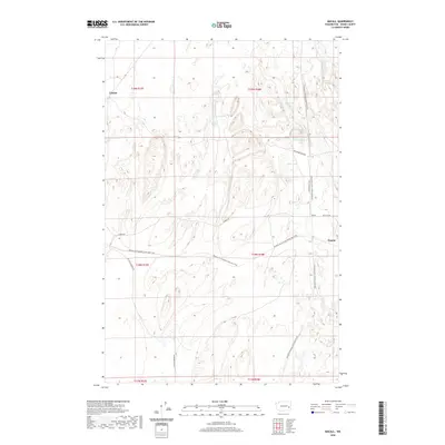
2020 Map of Macall
USGS Topo · Published 2020About this map
Emden, Macall, and Paxton anchor this portion of Adams County, where the dry landscape of the Channeled Scablands is defined by significant recreational and transportation corridors. The Columbia Plateau State Park Trail and the Palouse To Cascades State Park Trail intersect here, repurposing historic railroad grades that once fueled the regional wheat economy. These trails navigate a complex terrain of coulees and seasonal basins, passing water bodies such as Adams Lake, Horseshoe Lake, and Crane Lake. The map reveals a high-desert environment where drainage is characterized by the intermittent McElroy Cr and a network of rural routes like Harder Rd and Ritzville-Benge Rd. This survey documents the intersection of modern conservation and pioneer-era infrastructure, showing how the skeleton of the old rail lines now serves as a primary way to traverse the Washington interior.
Find a feature on this map
21 named features on this map. Tap any name to fly to it.
Don’t see what you’re looking for? This feature index may not catch every label — zoom into the map to look around manually.
Map Details
Editions of this 2020 Macall Map
This is the sole edition of this map. No revisions or reprints were ever made.
Other maps of this area
1950 · La Crosse
USGS Topo · 1:62,500
1950 · Benge
USGS Topo · 1:62,500
1952 · La Crosse
USGS Topo · 1:62,500
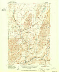
1952 · Benge
USGS Topo · 1:62,500
1953 · Walla Walla
USGS Topo · 1:250,000
1953 · Ritzville
USGS Topo · 1:250,000
1955 · Pullman
USGS Topo · 1:250,000
1955 · Spokane
USGS Topo · 1:250,000
1958 · Spokane
USGS Topo · 1:250,000
1958 · Pullman
USGS Topo · 1:250,000