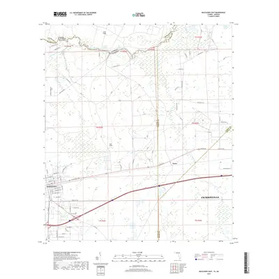
2018 Map of Macclenny East
USGS Topo · Published 2018About this map
The Big Bend of Saint Marys River defines the northern boundary of this landscape where the Florida-Georgia state line follows the winding water. The western edge is anchored by the growing community of Macclenny, with residential streets and local roads extending toward the more rural terrain of Mattox. Significant hydrological features such as Worley Lake, Shaw Lake, and the expansive Brandy Branch Swamp illustrate the low-lying, wetland character of the region.
Find a feature on this map
83 named features on this map. Tap any name to fly to it.
Don’t see what you’re looking for? This feature index may not catch every label — zoom into the map to look around manually.
Map Details
Editions of this 2018 Macclenny East Map
This is the sole edition of this map. No revisions or reprints were ever made.
Other maps of this area

1917 · Cambon
USGS Topo · 1:62,500

1917 · Macclenny
USGS Topo · 1:62,500

1918 · Middleburg
USGS Topo · 1:62,500

1918 · Lawtey
USGS Topo · 1:62,500

1918 · Cambon
USGS Topo · 1:62,500

1918 · Macclenny
USGS Topo · 1:62,500

1941 · Middleburg
USGS Topo · 1:62,500

1948 · Jacksonville
USGS Topo · 1:250,000

1949 · Fiftone
USGS Topo · 1:24,000
1949 · Middleburg
USGS Topo · 1:62,500