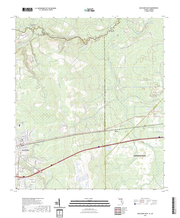
2024 Map of Macclenny East
USGS Topo · Published 2024About this map
The Baker County Courthouse stands as the central landmark for Macclenny in this detailed survey, where the town grid meets the swampy lowlands of the Saint Marys River basin. This border region is defined by the winding course of the river, which forms the boundary between Florida and Georgia. To the north, the sharp curve of The Big Bend of Saint Marys River and the elevation of Shaves Bluff provide contrast to the flatter wetlands like Brandy Branch Swamp and Barber Bay to the east.
Find a feature on this map
84 named features on this map. Tap any name to fly to it.
Don’t see what you’re looking for? This feature index may not catch every label — zoom into the map to look around manually.
Map Details
Editions of this 2024 Macclenny East Map
This is the sole edition of this map. No revisions or reprints were ever made.
Other maps of this area

1917 · Cambon
USGS Topo · 1:62,500

1917 · Macclenny
USGS Topo · 1:62,500

1918 · Middleburg
USGS Topo · 1:62,500

1918 · Lawtey
USGS Topo · 1:62,500

1918 · Cambon
USGS Topo · 1:62,500

1918 · Macclenny
USGS Topo · 1:62,500

1941 · Middleburg
USGS Topo · 1:62,500

1948 · Jacksonville
USGS Topo · 1:250,000

1949 · Fiftone
USGS Topo · 1:24,000
1949 · Middleburg
USGS Topo · 1:62,500