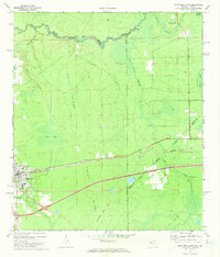
1972 Map of Macclenny East
USGS Topo · Published 1973About this map
The town of Macclenny serves as the focal point for this 1970s survey, situated where the Seaboard Coast Line railroad and local roads intersect. The landscape is defined by the prominent Trail Ridge landform and the winding path of the St Marys River, which forms the boundary between Georgia and Florida. This survey captures the rural infrastructure of Baker County, including the local High School and the Brandy Branch Ch located near the Nassau County line.
Find a feature on this map
30 named features on this map. Tap any name to fly to it.
Don’t see what you’re looking for? This feature index may not catch every label — zoom into the map to look around manually.
Map Details
Editions of this 1972 Macclenny East Map
This is the sole edition of this map. No revisions or reprints were ever made.
Other maps of this area

1917 · Cambon
USGS Topo · 1:62,500

1917 · Macclenny
USGS Topo · 1:62,500

1918 · Middleburg
USGS Topo · 1:62,500

1918 · Lawtey
USGS Topo · 1:62,500

1918 · Cambon
USGS Topo · 1:62,500

1918 · Macclenny
USGS Topo · 1:62,500

1941 · Middleburg
USGS Topo · 1:62,500

1948 · Jacksonville
USGS Topo · 1:250,000

1949 · Fiftone
USGS Topo · 1:24,000
1949 · Middleburg
USGS Topo · 1:62,500