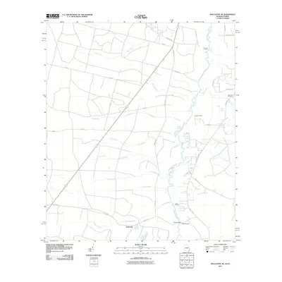
2011 Map of Macclenny NE
USGS Topo · Published 2011About this map
Stokesville serves as a focal point for this rural landscape along the Georgia-Florida border, where the meandering Saint Marys River defines the natural boundary. The region is characterized by a dense network of watercourses, including Mims Creek, Deep Creek, and several named branches such as School Branch and Tiger Branch, which drain into the main river channel. Local history and genealogy are anchored by several small burial grounds scattered across the terrain, notably Emmaus Cemetery, Deep Creek Cemetery, Pringle Cemetery, and Motes Cemetery. The infrastructure of the area relies on a series of county roads, with Stokes Bridge providing a critical crossing point over the river, linking the rural communities and homesteads that have long occupied these wetlands and pine woods.
Find a feature on this map
35 named features on this map. Tap any name to fly to it.
Don’t see what you’re looking for? This feature index may not catch every label — zoom into the map to look around manually.
Map Details
Editions of this 2011 Macclenny NE Map
This is the sole edition of this map. No revisions or reprints were ever made.
Other maps of this area

1917 · Cambon
USGS Topo · 1:62,500

1917 · Macclenny
USGS Topo · 1:62,500

1917 · Hilliard
USGS Topo · 1:62,500

1918 · Moniac
USGS Topo · 1:62,500

1918 · Cambon
USGS Topo · 1:62,500

1918 · Macclenny
USGS Topo · 1:62,500

1919 · Hilliard
USGS Topo · 1:62,500

1942 · Moniac
USGS Topo · 1:62,500

1948 · Jacksonville
USGS Topo · 1:250,000

1954 · Valdosta
USGS Topo · 1:250,000