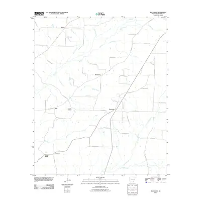
2011 Map of Macedonia
USGS Topo · Published 2011About this map
The Dorcheat Macedonia Oil Field defines much of the industrial landscape in this part of Columbia County, Arkansas, where a network of county roads connects rural settlements. The terrain is a complex web of drainage systems including Big Creek, Mill Creek, and Hurricane Creek, which flow southward through the undulating geography. Local history is anchored by small community centers like Macedonia and Philadelphia, with Macedonia Cemetery serving as a significant genealogical landmark for the region.
Find a feature on this map
58 named features on this map. Tap any name to fly to it.
Don’t see what you’re looking for? This feature index may not catch every label — zoom into the map to look around manually.
Map Details
Editions of this 2011 Macedonia Map
This is the sole edition of this map. No revisions or reprints were ever made.
Other maps of this area

1953 · El Dorado
USGS Topo · 1:250,000

1957 · El Dorado
USGS Topo · 1:250,000

1958 · El Dorado
USGS Topo · 1:250,000

1960 · El Dorado
USGS Topo · 1:250,000

1960 · Bussey
USGS Topo · 1:24,000
1960 · Taylor
USGS Topo · 1:24,000

1960 · Walkerville
USGS Topo · 1:24,000

1960 · Macedonia
USGS Topo · 1:24,000

1966 · Calhoun
USGS Topo · 1:24,000

1968 · Buckner
USGS Topo · 1:24,000