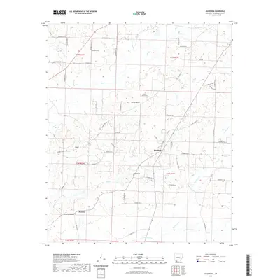
2020 Map of Macedonia
USGS Topo · Published 2020About this map
Macedonia and the surrounding rural communities of Columbia County define the character of this 2020 landscape in Southwest Arkansas. The settlement pattern is anchored by small historical centers such as Philadelphia, Harmony, and Dodson, connected by an intricate network of county roads. The terrain is marked by gentle undulations, including the named high point at Rocky Mound. Significant watercourses such as Hurricane Cr and Horsehead Cr drain the region, influencing the placement of early homesteads and roads. Local history and genealogy are centered at the Macedonia Cem, which serves as a central landmark for this dispersed agrarian community. The map reveals the persistence of these local place names and the enduring structure of the township and range system, which remains the primary framework for land division and property lines in this part of the state.
Find a feature on this map
63 named features on this map. Tap any name to fly to it.
Don’t see what you’re looking for? This feature index may not catch every label — zoom into the map to look around manually.
Map Details
Editions of this 2020 Macedonia Map
This is the sole edition of this map. No revisions or reprints were ever made.
Other maps of this area

1953 · El Dorado
USGS Topo · 1:250,000

1957 · El Dorado
USGS Topo · 1:250,000

1958 · El Dorado
USGS Topo · 1:250,000

1960 · El Dorado
USGS Topo · 1:250,000

1960 · Bussey
USGS Topo · 1:24,000
1960 · Taylor
USGS Topo · 1:24,000

1960 · Walkerville
USGS Topo · 1:24,000

1960 · Macedonia
USGS Topo · 1:24,000

1966 · Calhoun
USGS Topo · 1:24,000

1968 · Buckner
USGS Topo · 1:24,000