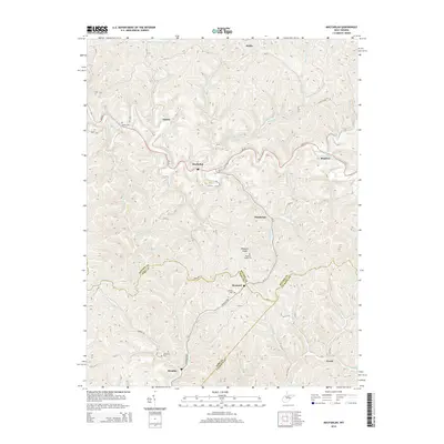
2014 Map of MacFarlan
USGS Topo · Published 2014About this map
Brohard and Macfarlan anchor this Appalachian landscape where the borders of Ritchie, Wirt, and Calhoun Counties converge. The topography is defined by the winding course of the South Fork Hughes River and its intricate network of tributaries, including Macfarlan Cr and Straight Cr. These valleys historically dictated the placement of small communities like Munday and Dutchman, which grew along the narrow bottomlands and ridge tops. Small family and community burial grounds, such as Nutter Cem, Hartley Cem, and Wolverton Cem, are scattered throughout the hills, providing valuable markers for local genealogical research. The road network, including WV-47 and numerous county routes like Munday Rd, follows the natural contours of the land, connecting isolated settlements such as Beatrice and Mellin across the dissected plateau of Pleasant Ridge.
Find a feature on this map
70 named features on this map. Tap any name to fly to it.
Don’t see what you’re looking for? This feature index may not catch every label — zoom into the map to look around manually.
Map Details
Editions of this 2014 MacFarlan Map
This is the sole edition of this map. No revisions or reprints were ever made.
Other maps of this area

1906 · Elizabeth
USGS Topo · 1:62,500

1907 · Harrisville
USGS Topo · 1:62,500

1907 · Arnoldsburg
USGS Topo · 1:62,500

1907 · Spencer
USGS Topo · 1:62,500

1924 · Harrisville
USGS Topo · 1:62,500

1924 · Elizabeth
USGS Topo · 1:62,500

1925 · Arnoldsburg
USGS Topo · 1:62,500

1926 · Elizabeth
USGS Topo · 1:62,500

1926 · Harrisville
USGS Topo · 1:62,500

1927 · Arnoldsburg
USGS Topo · 1:62,500