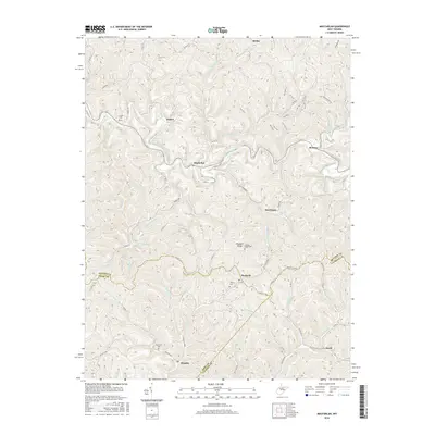
2016 Map of MacFarlan
USGS Topo · Published 2016About this map
The South Fork Hughes River meanders through the heart of this Appalachian landscape, where the borders of Ritchie, Wirt, and Calhoun counties meet. Small rural settlements like Macfarlan, Brohard, and Munday anchor a network of country roads and ridges that define the local geography. The map reveals a deeply dissected terrain of narrow hollows and high points like Frederick Ridge and Hartley Hill. Family history is preserved in several upland burial sites, including the Nutter Cem and Wolverton Cem. For genealogists and researchers, the detailed mapping of creeks like Dutchman Run and Straight Creek alongside specific county routes provides a clear picture of the residential patterns in this rural West Virginia corridor during the mid-2010s.
Find a feature on this map
75 named features on this map. Tap any name to fly to it.
Don’t see what you’re looking for? This feature index may not catch every label — zoom into the map to look around manually.
Map Details
Editions of this 2016 MacFarlan Map
This is the sole edition of this map. No revisions or reprints were ever made.
Other maps of this area

1906 · Elizabeth
USGS Topo · 1:62,500

1907 · Harrisville
USGS Topo · 1:62,500

1907 · Arnoldsburg
USGS Topo · 1:62,500

1907 · Spencer
USGS Topo · 1:62,500

1924 · Harrisville
USGS Topo · 1:62,500

1924 · Elizabeth
USGS Topo · 1:62,500

1925 · Arnoldsburg
USGS Topo · 1:62,500

1926 · Elizabeth
USGS Topo · 1:62,500

1926 · Harrisville
USGS Topo · 1:62,500

1927 · Arnoldsburg
USGS Topo · 1:62,500