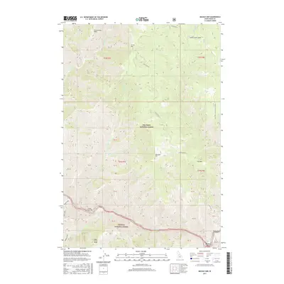
2017 Map of Mackay Bar
USGS Topo · Published 2017About this map
The Salmon River cuts deeply through the central Idaho wilderness, defining the boundary between the Nez Perce National Forest to the north and the Payette National Forest to the south. This remote reach is anchored by Mackay Bar, where the Mackay-Bar Rd terminates at the river's edge. The settlement is supported by the Mackay Bar Airport, a critical access point for this isolated canyon country. Upstream, Deadman Rapids marks a hazardous stretch of the water, while several named gravel bars like Indian Creek Bar indicate points of historical activity along the riverbanks.
Find a feature on this map
41 named features on this map. Tap any name to fly to it.
Don’t see what you’re looking for? This feature index may not catch every label — zoom into the map to look around manually.
Map Details
Editions of this 2017 Mackay Bar Map
This is the sole edition of this map. No revisions or reprints were ever made.
Other maps of this area

1931 · Buffalo Hump
USGS Topo · 1:125,000

1934 · Buffalo Hump
USGS Topo · 1:125,000

1956 · Warren
USGS Topo · 1:62,500

1956 · Elk City
USGS Topo · 1:250,000

1960 · Elk City
USGS Topo · 1:250,000

1977 · Silver Spur Ridge
USGS Topo · 1:24,000

1978 · Chicken Peak
USGS Topo · 1:24,000

1979 · Buffalo Hump
USGS Topo · 1:24,000

1979 · Dixie
USGS Topo · 1:24,000

1979 · Fivemile Bar
USGS Topo · 1:24,000