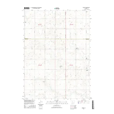
2015 Map of Mackey
USGS Topo · Published 2015About this map
Mackey sits at the heart of this agricultural landscape in Boone County, where the township lines of Dodge and Harrison meet. The map reveals a high concentration of small family and community burial grounds, such as Leininger Cem and South Marion Cem, which serve as vital markers for genealogical research in this part of central Iowa. The drainage pattern is defined by the winding paths of Squaw Cr and Montgomery Cr, which intersect the rigid grid of section roads.
Find a feature on this map
40 named features on this map. Tap any name to fly to it.
Don’t see what you’re looking for? This feature index may not catch every label — zoom into the map to look around manually.
Map Details
Editions of this 2015 Mackey Map
This is the sole edition of this map. No revisions or reprints were ever made.
Other maps of this area

1912 · Ames
USGS Topo · 1:62,500

1914 · Ames
USGS Topo · 1:62,500

1916 · Boone
USGS Topo · 1:62,500

1954 · Waterloo
USGS Topo · 1:250,000

1955 · Waterloo
USGS Topo · 1:250,000

1965 · Mackey
USGS Topo · 1:24,000

1965 · Fraser
USGS Topo · 1:24,000
1965 · Boone East
USGS Topo · 1:24,000
1965 · Boone West
USGS Topo · 1:24,000

1975 · Ames NW
USGS Topo · 1:24,000