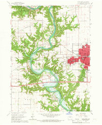
1965 Map of Boone West
USGS Topo · Published 1966About this map
The Des Moines River carves a deep valley through central Iowa in this mid-1960s study, where the landscape is undergoing a major transition with the development of the Saylorville Reservoir. The city of Boone serves as the eastern anchor, showing a dense street grid that includes Jr College and the Courthouse. To the west and south, the river valley is marked by an industrial and recreational legacy, featuring numerous Mine Dump sites and Gravel Pit operations alongside extensive parkland like Ledges State Park. The map documents small settlements such as Moingona and Logansport that are tied to the corridor's history. Genealogists will find a wealth of burial grounds, including the large Linwood Park Cemetery and smaller rural sites like Hickory Grove Cem and Rose Hill Cem. The era's transportation is defined by the Chicago and North Western tracks and an old railroad grade winding through Coal Valley.
Find a feature on this map
67 named features on this map. Tap any name to fly to it.
Don’t see what you’re looking for? This feature index may not catch every label — zoom into the map to look around manually.
Map Details
Editions of this 1965 Boone West Map
2 editions found
Other maps of this area

1911 · Madrid
USGS Topo · 1:62,500

1914 · Madrid
USGS Topo · 1:62,500

1916 · Boone
USGS Topo · 1:62,500

1950 · Perry
USGS Topo · 1:62,500

1951 · Perry
USGS Topo · 1:62,500

1951 · Ogden
USGS Topo · 1:62,500

1954 · Omaha
USGS Topo · 1:250,000

1954 · Waterloo
USGS Topo · 1:250,000

1954 · Fort Dodge
USGS Topo · 1:250,000

1954 · Des Moines
USGS Topo · 1:250,000