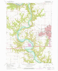
1965 Map of Boone West
USGS Topo · Published 1977About this map
Boone sits at the eastern edge of this mid-1960s landscape, serving as a hub for both industry and education with its concentrated grid featuring Franklin Sch, Lincoln Sch, and the Biblical College. To the west, the Des Moines River carves a deep, winding valley through the terrain, flanked by the newly established waters of Saylorville Lake. This era shows a transition in land use, where former extractive sites like a Mine Dump or various Gravel Pits are interspersed with recreational spaces like Ledges State Park and Mc Hose Park. The river valley is a focal point for historic transit, evidenced by the High Bridge and the path of the Chicago And North Western railroad. Small settlements and cemeteries such as Moingona, Logansport, and Oakwood Cem provide essential data points for genealogists tracing family roots in Boone Co. before late-century suburban expansion.
Find a feature on this map
76 named features on this map. Tap any name to fly to it.
Don’t see what you’re looking for? This feature index may not catch every label — zoom into the map to look around manually.
Map Details
Editions of this 1965 Boone West Map
2 editions found
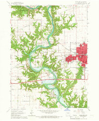
Other maps of this area

1911 · Madrid
USGS Topo · 1:62,500

1914 · Madrid
USGS Topo · 1:62,500

1916 · Boone
USGS Topo · 1:62,500

1950 · Perry
USGS Topo · 1:62,500

1951 · Perry
USGS Topo · 1:62,500

1951 · Ogden
USGS Topo · 1:62,500

1954 · Omaha
USGS Topo · 1:250,000

1954 · Waterloo
USGS Topo · 1:250,000

1954 · Fort Dodge
USGS Topo · 1:250,000

1954 · Des Moines
USGS Topo · 1:250,000