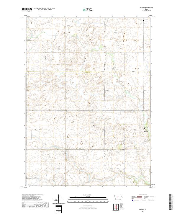
2022 Map of Mackey
USGS Topo · Published 2022About this map
Mackey stands as the central settlement on the boundary between Hamilton and Boone Counties, serving as a focal point for this agrarian landscape. The area is defined by a grid of rural routes such as Briggs Woods Rd and Co Hwy R27, which facilitate access to the surrounding farmsteads. Several historic burial grounds, including the Saint Pauls Evangelical Lutheran Cem and Leininger Cem, are preserved across the townships, offering significant resources for genealogical research. The drainage pattern is marked by the winding paths of Crooked Cr, Ioway Cr, and Montgomery Cr, which cut through the level terrain. This modern survey by the U.S. Geological Survey illustrates the enduring rural structure of the region, where the intersection of township lines and creek beds continues to dictate the local geography.
Find a feature on this map
37 named features on this map. Tap any name to fly to it.
Don’t see what you’re looking for? This feature index may not catch every label — zoom into the map to look around manually.
Map Details
Editions of this 2022 Mackey Map
This is the sole edition of this map. No revisions or reprints were ever made.
Other maps of this area

1912 · Ames
USGS Topo · 1:62,500

1914 · Ames
USGS Topo · 1:62,500

1916 · Boone
USGS Topo · 1:62,500

1954 · Waterloo
USGS Topo · 1:250,000

1955 · Waterloo
USGS Topo · 1:250,000

1965 · Mackey
USGS Topo · 1:24,000

1965 · Fraser
USGS Topo · 1:24,000
1965 · Boone East
USGS Topo · 1:24,000
1965 · Boone West
USGS Topo · 1:24,000

1975 · Ames NW
USGS Topo · 1:24,000