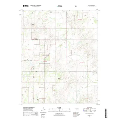
2018 Map of Mackie
USGS Topo · Published 2018About this map
The Washita River meanders across the northern reaches of this Roger Mills County landscape, defining a terrain shaped by the tributaries of Rush Cr and Croton Cr. The area is characterized by the significant presence of the Black Kettle National Grassland, with numerous parcels labeled as Bkng interspersed throughout the sections of Township 14 and 15 North. These federal lands represent a unique conservation history in the Oklahoma panhandle region, where reclaimed dust bowl acreage serves as a public commons.
Find a feature on this map
39 named features on this map. Tap any name to fly to it.
Don’t see what you’re looking for? This feature index may not catch every label — zoom into the map to look around manually.
Map Details
Editions of this 2018 Mackie Map
This is the sole edition of this map. No revisions or reprints were ever made.
Other maps of this area

1955 · Clinton
USGS Topo · 1:250,000

1957 · Clinton
USGS Topo · 1:250,000

1960 · Cheyenne
USGS Topo · 1:62,500

1961 · Reydon
USGS Topo · 1:62,500

1965 · Crawford
USGS Topo · 1:24,000

1966 · Roll
USGS Topo · 1:24,000

1966 · Durham
USGS Topo · 1:24,000

1984 · Foss Reservoir
USGS Topo · 1:100,000

1988 · Dempsey
USGS Topo · 1:24,000
1989 · Cheyenne NW
USGS Topo · 1:24,000