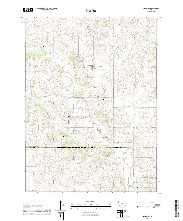
2022 Map of Macksburg
USGS Topo · Published 2022About this map
Macksburg sits at the heart of this agricultural landscape in Madison County, where the terrain is defined by the winding course of the Thompson River and several smaller tributaries. This modern topographic study shows a rural network of section-line roads, including Macksburg Rd and Co Rd G61, that connect the town to outlying farmsteads. For genealogists and local historians, the map is remarkably dense with burial grounds, documenting the locations of Dodge Center Cem, West Branch Cem, Hickman Cem, and Kivett Cem, among others. These sites, along with family-named landmarks like Moon Cem and Boone Cem, reveal the long-standing settlement patterns of the region. The map also traces various branches of the Clanton Creek system, such as N Fork Clanton Cr, illustrating the drainage patterns that have shaped Iowa's fertile farmland.
Find a feature on this map
77 named features on this map. Tap any name to fly to it.
Don’t see what you’re looking for? This feature index may not catch every label — zoom into the map to look around manually.
Map Details
Editions of this 2022 Macksburg Map
This is the sole edition of this map. No revisions or reprints were ever made.
Other maps of this area

1951 · Afton
USGS Topo · 1:62,500

1952 · Winterset
USGS Topo · 1:62,500

1954 · Greenfield
USGS Topo · 1:62,500

1954 · Omaha
USGS Topo · 1:250,000

1957 · Omaha
USGS Topo · 1:250,000

1958 · Omaha
USGS Topo · 1:250,000

1980 · Creston East
USGS Topo · 1:24,000

1981 · Zion
USGS Topo · 1:24,000
1983 · Afton
USGS Topo · 1:24,000
1983 · Lorimor South
USGS Topo · 1:24,000